Anchorage to Homer: Sterling Highway Driving Guide & Stops
Journey to the Halibut Capital of the World. Drive alongside the world-famous turquoise Kenai River, gaze at active Cook Inlet volcanoes, and arrive at Homer Spit jutting 4.5 miles into Kachemak Bay.
Driving from Anchorage to Homer covers 223 miles across the Seward and Sterling Highways (AK-1), requiring 4.5 to 5.5 hours. The route passes Cooper Landing's turquoise Kenai River, Soldotna's salmon centers, and coastal bluffs of Cook Inlet before reaching the Homer Spit.
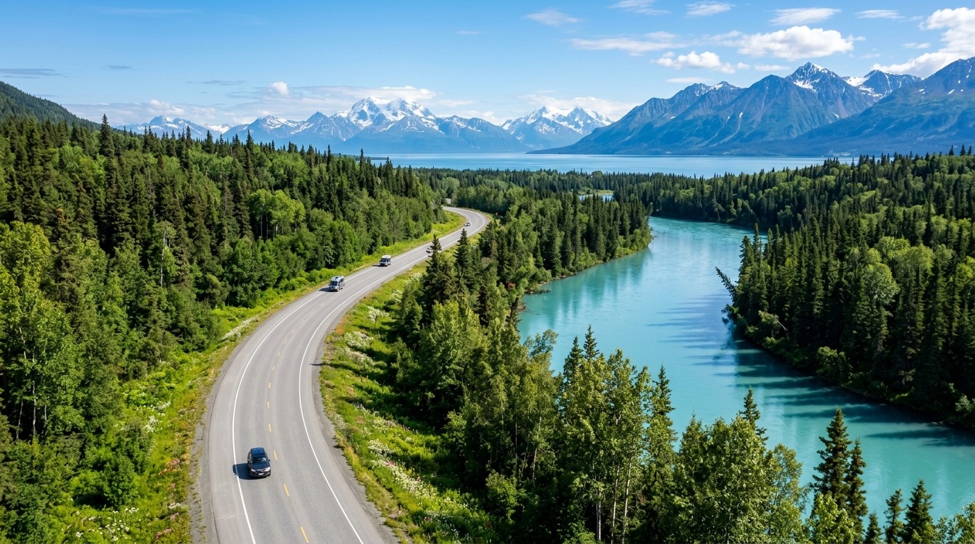
Route Overview & Landscape Narrative
The drive from Anchorage to Homer is the ultimate Kenai Peninsula road trip. It branches from the Seward Highway at Tern Lake (MP 37) onto the Sterling Highway, transitioning from rugged alpine passes to world-class salmon rivers and dramatic coastal volcano panoramas.
Cooper Landing & Turquoise Kenai River Salmon Corridor
Departing Tern Lake, the Sterling Highway winds westward through Cooper Landing along the upper reaches of the world-famous turquoise Kenai River. This 17-mile river corridor is universally recognized as the world capital of sport salmon fishing, having produced the world-record 97-pound King Salmon.
Between June and August, thousands of anglers line the gravel banks at Russian River Ferry (Milepost 55) to catch combat-style sockeye salmon runs while Alaskan brown bears forage along the falls. The extraordinary glacial cyan hue of the river is caused by glacial flour?microscopic silt particles suspended in runoff from Kenai Lake.
Cook Inlet Active Volcano Panoramas: Mt. Redoubt & Mt. Iliamna
West of Soldotna (Milepost 95), the highway swings south toward Cook Inlet, offering breathtaking vistas of active snow-clad stratovolcanoes rising directly out of the ocean water across the inlet. The skyline is dominated by Mount Redoubt (10,197 ft), Mount Iliamna (10,016 ft), and Mount Augustine (4,134 ft).
Several coastal turnouts between Clam Gulch (MP 118) and Ninilchik (MP 135) provide mounted viewing scopes where travelers can capture panoramic landscape photographs of steaming volcanic peaks reflecting in the tidal waters of Cook Inlet.
Mile-by-Mile Turnout Index: Sterling Highway
? MP 48.0 - Cooper Landing Kenai River Access: Scenic put-in for Kenai River drift boat trips and world-class fly fishing. ? MP 55.0 - Russian River Campground & Falls: Trailhead to Russian River Falls where thousands of sockeye salmon leap up bedrock cascades while brown bears fish. ? MP 95.0 - Soldotna Visitor Center & Boardwalk: Elevated wooden fishing platforms along the Kenai River in downtown Soldotna. ? MP 118.0 - Clam Gulch State Recreation Area: Coastal bluff overlook with expansive views across Cook Inlet to Mt. Redoubt. ? MP 135.0 - Ninilchik Historic Village & Bluff: Historic 1901 Russian Orthodox Holy Transfiguration Church perched on an ocean cliffside. ? MP 157.0 - Anchor Point Westernmost Highway Point: Westernmost continuous highway point in North America with active tractor beach boat launches. ? MP 169.0 - Homer Hilltop Panoramic Overlook: Iconic panoramic view looking down upon Homer Spit, Kachemak Bay, and the Kenai Mountains. ? MP 170.0 - Homer Spit Terminus: End of the Sterling Highway jutting 4.5 miles into Kachemak Bay surrounded by glaciers and marine docks.
Ninilchik Russian Heritage & Anchor Point Westernmost Milestone
At Milepost 135, explore the historic village of Ninilchik, established in 1847 by Russian colonists. The iconic Holy Transfiguration of Our Lord Russian Orthodox Church, with its distinctive golden onion domes, sits atop a seaside bluff overlooking the inlet.
Further south at Milepost 157, Anchor Point marks the most westerly point on the North American continuous highway system. Watch massive industrial tractors launch commercial halibut charter dories directly into the ocean surf from the sandy gravel beach.
Homer Spit Terminus & Kachemak Bay Gateway
The drive culminates with a spectacular descent into Homer. The Homer Spit is a natural 4.5-mile gravel spit extending into Kachemak Bay, lined with seafood shacks, art galleries, and commercial fishing docks. From Homer Harbor, water taxis provide daily access to the roadless artist enclave of Halibut Cove and the hiking trails of Kachemak Bay State Park.
Key Scenic Highlights & Points of Interest
- ?Cooper Landing (MP 48): Epic fly-fishing and rafting epicenter on the turquoise Kenai River.
- ?Russian River Ferry & Falls (MP 55): Prime sockeye salmon run and brown bear viewing corridor.
- ?Soldotna (MP 95): Commercial service hub with extensive grocery stores, fuel stations, and riverfront parks.
- ?Ninilchik Village & Russian Orthodox Church (MP 135): Iconic 1901 Holy Transfiguration Church overlooking Mt. Redoubt.
- ?Cook Inlet Volcano Overlook (MP 150): Panoramic vistas of active volcanoes Mt. Iliamna, Mt. Redoubt, and Mt. Augustine.
- ?Homer Spit (MP 170): 4.5-mile gravel spit featuring boardwalk shops, seafood shacks, and charter boat docks.
Essential Driving Tips & Subarctic Safety
Sterling Highway construction projects between MP 45 and MP 60 (Cooper Landing Bypass) can cause 20-minute traffic delays during summer.
Watch for slow-moving RVs and boat trailers; utilize designated slow-vehicle turnouts to let traffic pass safely.
Moose are extremely prevalent in the Kenai National Wildlife Refuge; scan highway ditches diligently at twilight.
Mile-by-Mile Logistical Timeline: Sterling Highway Corridor
Official Ground-TruthCooper Landing Kenai River Access
Scenic put-in for Kenai River drift boat trips and world-class sockeye fishing.
Russian River Campground & Falls
Trailhead to Russian River Falls where salmon jump and brown bears fish.
Soldotna Visitor Center & Boardwalk
Elevated wooden fishing platforms along the Kenai River in downtown Soldotna.
Ninilchik Historic Village & Bluff
Historic Russian-Alaskan village with domed church on ocean cliffside.
Anchor Point Westernmost Point
Tractor beach launch for saltwater fishing boats and Cook Inlet sunset overlook.
Homer Spit Terminus
End of the Sterling Highway jutting into Kachemak Bay surrounded by glaciers and mountain peaks.
Calculate Gas Cost for Anchorage to Homer: Sterling Highway Driving Guide & Stops
Estimate fuel volume and expenditure for your specific vehicle configuration along this corridor:
1. Configure Your Route
2. Vehicle & Fuel Details
Estimated Total Fuel Expenditure
Longest fuel gap on this route is 90 miles between Girdwood and Seward. Always top off before leaving town.
Frequently Asked Questions: Anchorage to Homer: Sterling Highway Driving Guide & Stops
What is the speed limit and road condition on the Sterling Highway Corridor?
The standard posted speed limit is 55 MPH for two-lane stretches and up to 65 MPH on select divided sections. Road conditions are fully paved and maintained year-round, though seasonal summer construction and winter black ice require attentive driving.
Where is the longest fuel gap on the Anchorage to Homer: Sterling Highway Driving Guide & Stops?
The longest stretch without gas services is 55 miles. Fuel stations are plentiful in Soldotna (MP 95) and Cooper Landing (MP 48), with smaller stations in Ninilchik and Anchor Point.
Make Alaska Travel Pros a Preferred Source
Keep Alaska itineraries and road-trip guides highlighted in Google Search.